
History
The making of the Casbah
Twenty-six centuries of occupation on one steep hillside above the bay of Algiers, from a Phoenician anchorage to a World Heritage Site that fifty thousand people still call home.
The Casbah is not a monument. It is a quarter that has been lived in without a break since before Rome, rebuilt by every power that has held the bay, and damaged by most of them. This is how it came to look the way it does.
Before there was a Casbah
The bay has been in use for a very long time. UNESCO records occupation of the site from at least the sixth century BC, when Phoenician traders established a post here. The Romans came later and called the place Icosium, a name Britannica still lists among the alternatives for the modern city.
Almost nothing of either survives above ground inside the medina. What they left is the reason anyone settled here in the first place: a sheltered anchorage with a steep hill behind it, easy to defend and impossible to approach unseen.
The tenth century, and a word that moved
The city that became Algiers was founded in the tenth century by Berbers under the Zirid dynasty, according to the Directorate of Tourism and Handicrafts of Algiers. It was built where the hill meets the water, and it has kept that shape ever since.
The word casbah has shifted meaning underneath it. In the Zirid period it named only the highest point of the medina, the citadel at the summit. Today, as UNESCO puts it, the term covers the whole of the old town bounded by the ramparts. When people say the Casbah now, they mean the entire hillside, not the fortress that once owned the word.

Algiers modelled as it stood in 1830, the medina still complete between the citadel and the sea.
Ottoman Algiers, and the century of fountains
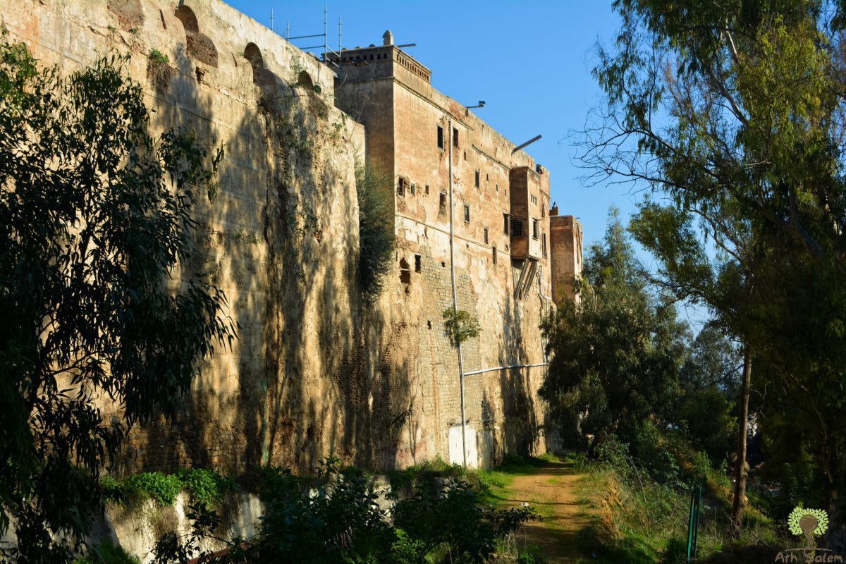
In the sixteenth century Algiers passed into the Ottoman Empire, ending a run of Arab and Amazigh dynasties that Britannica dates from the eighth. The ramparts that still define the area UNESCO protects went up in the late sixteenth century, and the medina took the form it holds today: a lower town of mosques and palaces, and an upper town of winding, whitewashed, exclusively pedestrian streets.
The clearest measure of how the city was doing is not a population figure. It is the fountains. Algiers had no river. Everything it drank came down aqueducts from the hills behind it and was handed out at public fountains set into the street walls. There were seven of them in the sixteenth century. By 1674 there were a hundred and twenty five.
Most were built in the eighteenth century by the deys. An official called the khudjat al-‘uyun, the secretary of the fountains, ran an administration funded by habus endowments for no purpose other than keeping them flowing, and each fountain carried a marble or shale plaque in Arabic or Ottoman Turkish naming whoever had paid for it. In the 1790s Dey Hassan Pasha enlarged Ketchaoua into the principal mosque of the lower Casbah. The record gives both 1792 and 1794.
1830: a fly whisk and six hundred ships
On 30 April 1827, in an argument that had begun over a debt, Dey Hussein ben Hassan struck the French consul Pierre Deval with a fly whisk. France chose to treat it as an insult requiring an answer. A blockade of Algiers began on 11 June that year under Rear Admiral Joseph Collet.
Three years later the answer arrived in full. A fleet of six hundred ships left Toulon on 11 May 1830. On 14 June, General de Bourmont landed thirty-four thousand troops at the Sidi Fredj peninsula. The bombardment of the city began on 4 July. On 5 July Algiers surrendered and Dey Hussein went into exile.
What happened inside the medina immediately afterwards is recorded without euphemism: French soldiers pillaged the Muslim city and desecrated many of its holy places and cemeteries.
A hundred and thirty two years
In 1832 the French took Ketchaoua for Christian worship, and in 1845 it was consecrated as the cathedral of Saint Philippe. It served as a church for about a hundred and thirty years. By 1847 French forces had largely suppressed Algerian resistance, and in 1848 Algeria was formally made a département of France.
The lower Casbah took the worst of it. A new colonial city was laid out beside and partly over the old one, and the medina, which had been the seat of government for three centuries, was reduced to a quarter. Power and trade moved out. The upper town, too steep and too narrow for any of it, was left more or less alone, which is the reason its medieval street plan is still there to walk.

The citadel surveyed in 1830. The plan was drawn by the people who had just taken it.
1954 to 1962
During the war of independence the Casbah became a stronghold of the FLN, and its geometry was the reason. Alleys too narrow for a vehicle, doors that open onto blank walls, and roof terraces that step down the slope almost continuously made the quarter defensible in a way no planned city could be. The fighting of 1957 went through it house by house.
That period has its own page, because it deserves more than a paragraph: the Casbah during the Algerian war.
After independence
Independence came in 1962, and the first Friday prayer in over a century was held again in Ketchaoua. But the Casbah did not become the centre again. The institutions of the new state were in the modern city, and the medina stayed what the colonial period had made it: a dense residential quarter with an extraordinary history and no particular function in the machinery of the capital.
Recognition followed slowly. The Casbah was listed as a national historic site in 1991 and inscribed on the UNESCO World Heritage List in 1992, under criteria ii and v, covering 54.7 hectares. In 2003 it was designated a safeguarded sector. Roughly fifty thousand people live inside the inscribed area.
The condition it is in
Restoration has been attempted in pieces. In 1986 the Aga Khan Trust for Culture rebuilt a three-storey courtyard house from ruin to its original form, the first of fifty-eight structures within a programme that was meant to reach seventeen hundred homes.
The scale of what is still wrong was set out plainly in 2021: more than a third of the buildings had collapsed or were unsafe, around three hundred were destroyed, four hundred and fifty were abandoned and boarded up, two hundred were in advanced deterioration, and only fifty had been restored. Two hundred and fifty houses were still lived in by the families that owned them. The Algerian government allocated twelve million euros to begin a rescue plan.
There has been real progress too. Ketchaoua reopened on 9 April 2018 after four years of restoration funded by the Turkish state under a protocol signed in September 2013.
UNESCO lists the standing threats to the site as earthquake, fire, landslide and flood. To that list anyone who has walked the upper streets would add the simpler one: a house that nobody can afford to repair comes down eventually, and the street it was holding up comes down with it.
At a glance
Key dates
Every date below is drawn from the sources listed at the foot of this page.
- 6th c. BCA Phoenician trading post is established on the bay.
- 10th c.Berbers of the Zirid dynasty found the city that becomes Algiers.
- 16th c.Algiers passes to the Ottomans. The ramparts close around the medina.
- 1674One hundred and twenty five public fountains are recorded in the city.
- 1792Dey Hassan Pasha enlarges Ketchaoua into the great mosque of the lower town. The record gives 1792 and 1794.
- 30 Apr 1827Dey Hussein strikes the French consul with a fly whisk.
- 5 Jul 1830Algiers surrenders. The dey goes into exile.
- 1832The French take Ketchaoua for Christian worship. It is consecrated as the cathedral of Saint Philippe in 1845 and serves as a church for about 130 years.
- 1848Algeria is made a département of France.
- 1957The fighting of the Battle of Algiers passes through the Casbah house by house.
- 1962Independence. The first Friday prayer in over a century returns to Ketchaoua.
- 1986The Aga Khan Trust rebuilds the first of fifty-eight houses.
- 1991The Casbah is listed as a national historic site.
- 1992UNESCO inscribes the Casbah under criteria ii and v.
- 2003The Casbah is designated a safeguarded sector.
- 2018Ketchaoua reopens on 9 April after four years of restoration.
Keep reading
Where this leads


Sources
Where this comes from
- UNESCO World Heritage Centre, Kasbah of Algiers
- Direction of Tourism and Handicrafts, Algiers
- ICESCO Islamic World Heritage Portal, Kasbah of Algiers
- Discover Islamic Art, Museum With No Frontiers, public fountains of Algiers
- TİKA, restoration and reopening of the Ketchaoua Mosque
- Archnet, Casbah House Restoration, Aga Khan Trust for Culture
- EBSCO Research Starters, France Conquers Algeria
- Britannica, Algeria
- Med-Or, the restoration project of the Casbah of Algiers
Casbah of Algiers
An independent record of the medina of Algiers, its architecture, its history and its people. Written and maintained by Samir Sibachir.
© 2026 casbah-alger.comEvery figure on this page is traceable to the sources listed above.